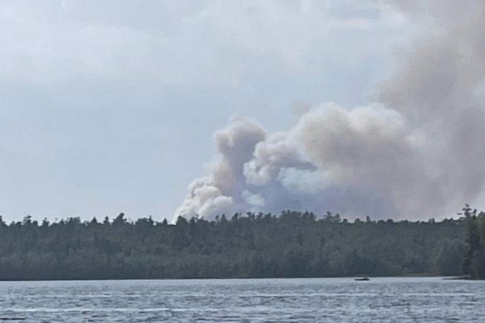
UPDATE – As of Sunday (August 10) at 12:30 p.m., both the HAL016 and HAL017 fires near Head Lake east of Norland in Kawartha Lakes are under control. The HAL018 fire south of Bancroft in Hastings County and HAL019 fire south of Kinmount remain out of control, with the latter now having grown to 27 hectares.
Four forest fires have started in the Kawarthas region since early Friday evening (August 8), according to the Ministry of Natural Resources (MNR), and three are currently out of control.
The fires are identified by the prefix HAL representing MNR’s Haliburton fire management area, but three are located in Kawartha Lakes and one is located Hastings County.
Two of the fires — HAL016 and HAL017 — are located near Head Lake east of Norland in Kawartha Lakes. HAL016 is just west of Head Lake and HAL017 is north of Head Lake in Queen Elizabeth II Wildlands Provincial Park.
According to the MNR, HAL016 started at 5:56 p.m. on Friday, is 4.5 hectares in size, and is not under control.
HAL017 started at 6:58 p.m. on Friday, is 1.6 hectares in size, and is currently being held.
A fire called HAL018, located in Hastings County south of Bancroft and east of Apsley, started at 11:42 a.m. on Saturday, is 11 hectares in size, and is currently not under control.
A fourth fire, HAL019, is located east of Burnt River between Bobcaygeon and Kinmount in Kawartha Lakes. It started at 5:03 p.m. on Saturday, is now 27 hectares in size, and is currently not under control.
According to posts on social media, water bombers have been seen flying in the area to help fight HAL019.
For that fire, the Ontario Provincial Police is asking everyone to avoid the area of County Road 49 between Parkside Drive and County Road 121 in Somerville Township, between Kinmount and Bobcaygeon, as crews are responding to the fire.
VIDEO: HAL019 between Bobcaygeon and Kinmount
The causes of the forest fires are not yet known. There are total fire bans in place in both Kawartha Lakes and Hastings Highlands.


