


")
For those who love the cold, this past winter may be one for the books. With abundant snow across the Kawarthas, many set aside hibernation in favour of skis, skates, and snowshoes.
It was easy to forget the conversations about wildfire risk that had dominated just months earlier.
The summer of 2025 told a very different story. It was among the hottest and driest on record in the region. Across Ontario, more than 640 wildfires burned between April and October, consuming roughly 6,000 square kilometres — an area larger than Prince Edward Island. By autumn, it ranked as the province’s second-worst wildfire season on record.
Research from the Canadian Forest Service, spanning more than six decades, shows that wildfires in Canada are becoming larger, longer lasting, and more destructive. These trends point to a growing need to adapt to climate-related risks — not only in remote forests and parks, but also where people live.
“There’s still a lot of damage that we’re working through from the ice storm,” says Peterborough resident Lyn Jones. “It’s difficult to know what to prioritize and how to better protect and support the forest on our property.”
Questions like these are becoming more common. Aaron Hill, president of the Peterborough firm Basterfield and Associates that specializes in landscape architecture, urban design, and environmental planning, says interest in wildfire preparedness has grown significantly.
“Hotter summers and shifting weather patterns are increasing the likelihood and intensity of fire events,” Hill explains. “As these risks evolve, so does the need to understand how fire might interact with a property.”
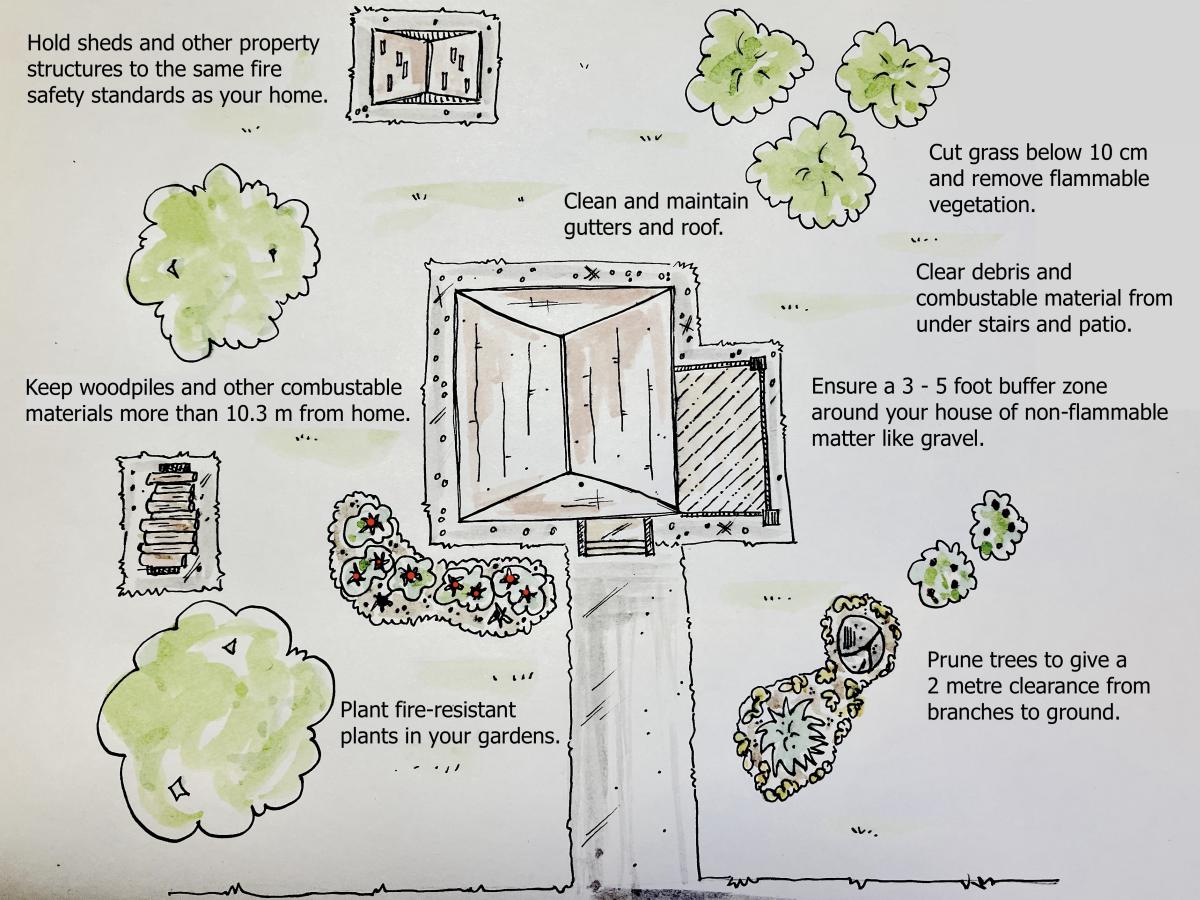
Breaking risk into visible, manageable elements helps property owners understand potential problems. This can be done through a fire hazard assessment, which offers a structured way to evaluate potential “fuel ladders” — accumulations of branches, brush, and debris that allow fire to climb from the ground into the forest canopy — as well as slope, proximity to structures, and areas where wind-driven embers may collect.
Hill observes that demand for fire hazard assessment is rising as wildfire risk expands into more populated areas.
“Many people want to protect their cottages or rural homes but aren’t sure where to start,” he says. “An assessment helps bridge that gap. It shows which actions will be most effective while still maintaining ecological integrity.”
Whether homeowners conduct an assessment themselves or hire a professional, a key first step is understanding the types of wildfires most likely to affect their property.
Surface fires are the most common in urban and semi-urban settings. They burn materials on or near the ground, such as leaves, grass, fallen branches, and other debris. Crown fires, by contrast, move through the tops of trees, spreading rapidly from treetop to treetop and are sometimes carried by wind.
For properties near wooded areas or along the suburban fringe, experts recommend creating a well-managed safety zone around the home. Typically extending 100 to 200 feet, this zone can significantly reduce fire risk.
However, fire mitigation does not mean stripping a property of its natural character.
Thoughtful fuel reduction can support biodiversity by preserving mature native trees while reducing stressors such as overcrowding, accumulated debris, and low-hanging limbs. Spacing out conifer trees, thinning dense undergrowth, trimming or removing fuel ladders, and clearing combustible materials near buildings all are actions that follow established wildfire mitigation practices and can also improve overall forest health.
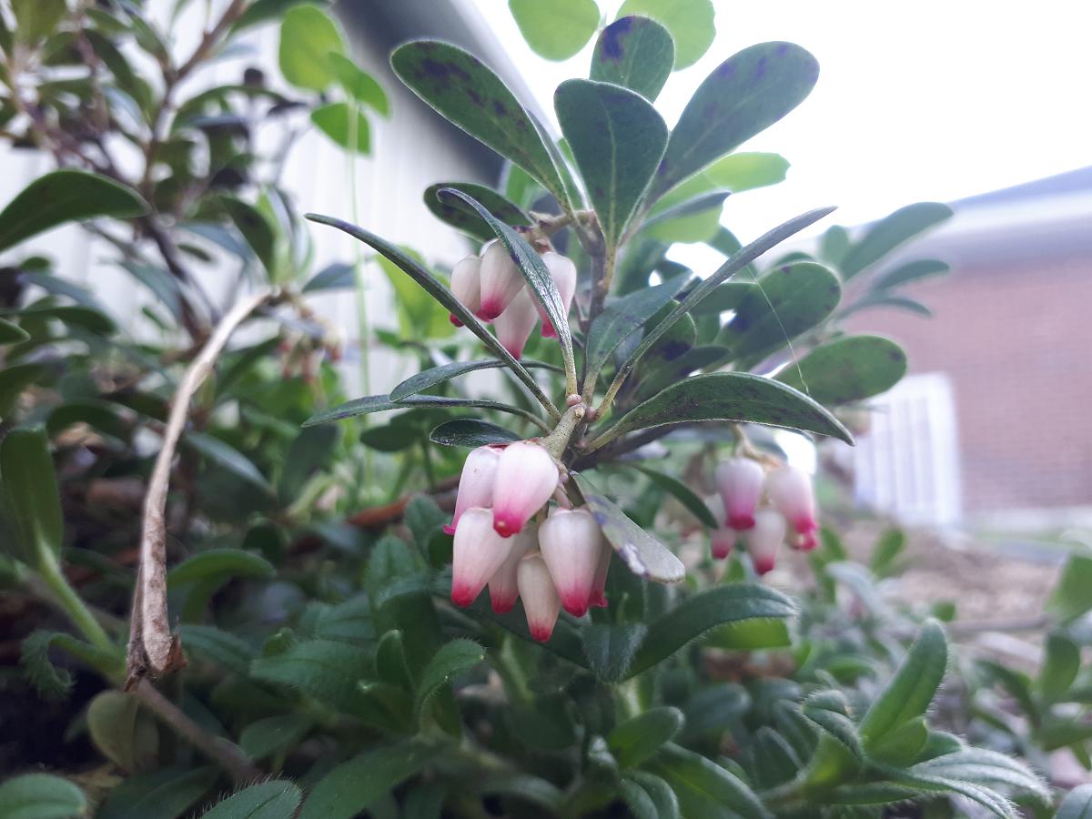
Plant selection can also play a role. “Fire-smart” plants — generally low-growing species with thick, moisture-rich leaves — are more resistant to burning. Native options such as nannyberry, columbine, wintergreen, bearberry, and wild geranium can help create a more resilient landscape while maintaining ecological value.
At its core, Hill says, a fire hazard assessment is as much about education as it is about risk reduction.
“When property owners understand how fire risk develops, and how manageable many of the solutions are, they become stronger partners in building community resilience,” he says. “Small actions, taken across many properties, can add up to meaningful protection.”
As climate patterns continue to shift, the threat of wildfire is expected to evolve. With accessible tools, clear guidance, and engaged communities, preparedness can grow alongside it.
Fire hazard assessments offer a practical path forward, helping property owners protect the places they love while supporting the long-term health of forests, waterways, and shared natural spaces across the Kawarthas region.
For more information on fire-smart landscaping, visit www.ontario.ca/page/firesmart-landscaping.
Basterfield and Associates is a member of GreenUP’s Green Economy Peterborough (GEP) program, a network that supports local businesses in sustainable practices. Learn more and sign up for the GEP newsletter at www.greeneconomypeterborough.ca.


