


")
While March sunshine and warmer temperatures could have you eager to crack open a cold drink on the patio and pull out the swimsuits, water management representatives warn that it’s not all a cause for celebration in the Trent River watershed.
“We could be in for a very different summer,” warns North Kawartha Township Mayor Carolyn Amyotte.
The difference comes from the fallout of a premature spring thaw, subnormal precipitation, and unseasonable temperatures throughout the winter. Surveys by Parks Canada — which is responsible for water management along the Trent-Severn Waterway — show that in the Haliburton area alone, total precipitation has been below average every month since September 2023 and was just 35 per cent of normal in February 2024.
“Normally when we get to this time of year, there’s a great deal of water stored all through the Trent River basin and it’s stored as snowpack,” says Ted Spence, executive committee chair of the Coalition for Equitable Water Flow (CEWF) and a retired professor with an academic focus in environmental planning and hydrology.
“The snowpack was already less than 60 per cent in the northern areas, ranging down to essentially zero as you get further down in the basin. Now it’s closer to zero everywhere.”
CEWF is a volunteer organization established in 2008 to represent those who own residential shoreline property on 35 reservoir and 20 flow-through lakes located in Haliburton County and northern Peterborough County, in the Haliburton sector of the Trent River watershed. CEWF acts as the liaison between the membership lake associations and the Parks Canada Trent-Severn water management team, which maintains the water levels for all lakes through dam operations.
VIDEO: Coalition for Equitable Water Flow
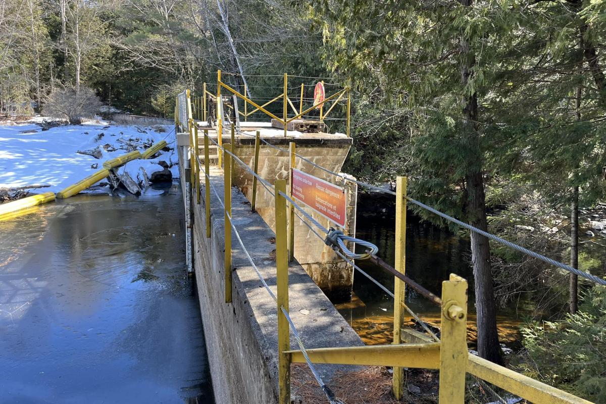
With below-typical precipitation causing a lack of stored water, Parks Canada is managing the dams throughout the system and logs have now been added to all reservoir lake dams to gradually build water levels.
“If we start to get normal precipitation, they would be aiming to get (reservoir lakes) up to 75 or 80 per cent by the end of April,” says Spence, who resides in Peterborough but cottages on Catchacoma Lake, which is a part of the Mississauga Lake chain, the largest reservoir in the waterway. “In a normal year, they would be looking to get the whole system up to about 90 per cent in early May.”
Spence suggests this water monitoring activity is happening about a month ahead of when it typically would and, combined with the early winter run-off, water levels on the lakes are coming up “a few centimetres per day.”
“The lakes are all higher than they would normally be on this date, but there’s nothing sitting upstream to come down to finish filling them,” Spence points out. “The water level on your lakes is going up earlier than you would expect.”
Monitoring of water levels doesn’t stop at the northern reservoir lakes, but goes all the way down through the system.
“We have to fill the whole system and, right now, the downstream parts like the Trent River and Otonabee River through Peterborough have been reduced to minimum flows in order to allow the canal lakes and the Kawartha Lakes to be filled above, and for the reservoirs to fill,” Spence says. “To have that happening in March is exceptional.”
After the reservoir lakes are filled in late spring, water is gradually drawn from the lakes over the summer months until fall to support boat navigation in the Trent-Severn Waterway system.
Though spring thaws often prompt concerns of flooding, that is of less concern this year given the lack of snowmelt. What could be an issue to property owners, however, is shoreline damage caused by ice breaking up on the lakes.
“Most of the northern lakes still have ice cover which has broken away from the shore as the water level came up and the weather got warmer, and it’s breaking up and it can blow with high winds,” Spence says. “We know that shorelines are very vulnerable to ice damage and anybody who leaves structures in the water, like docks or posts, are always susceptible to damage from blowing ice, but this is certainly earlier (than usual).”
As for Mayor Amyotte, who resides on Eels Lake (a reservoir lake located north of Apsley) and is the representative on the Upper Trent Water Management Partnership, the risk lies in the months ahead should there not be increased levels of precipitation.
“If we’re starting off this season super dry, it wouldn’t surprise me to see us having fire bans starting off quite quickly,” she says. “Having a forest that’s under stress because it’s so dry is not good for potential fire risk.”
Amyotte notes too that, with the increased sunshine, any precipitation is more likely to evaporate than it is to be absorbed into the watershed, and that drought could change the migratory patterns of birds and animals, among other impacts on the ecosystems.
“When ecosystems are under stress because of droughts, they’re more susceptible to pests and diseases,” she says. “It has far-ranging consequences, and not only on our enjoyment of being able to fish or paddle downstream.”
While Amyotte and Spence both agree there is no need for cottage owners to rush up to their properties ahead of schedule, they should be prepared to operate differently this year.
“You may be moving your dock out a little sooner than you’re used to,” says Amyotte. “You may want to consider extending your water line in the lake if it’s in a spot that can get shallow — certainly for those reservoir lakes.”
She also encourages property owners to think ahead about proactive measures like installing rain barrels and to check out firesmartcanada.ca for tools and resources on taking inventory to monitor potential fire risks and safety measures.
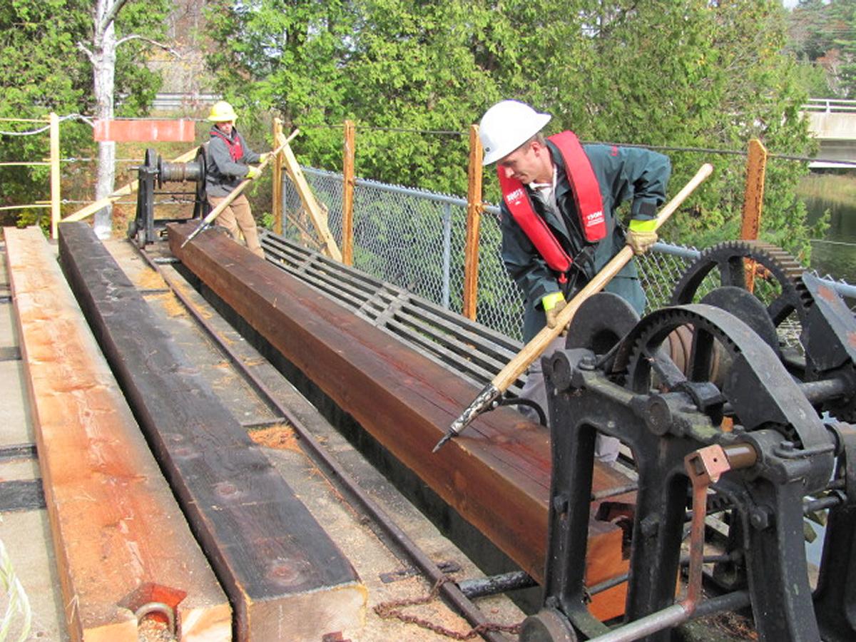
For now, Spence assures that most dams have automated water gauges and that the Trent-Severn water management team gets “real-time data” which alters their ongoing management of water levels.
“Trent-Severn is doing everything they can to protect the interests of everybody in the basin by storing as much water as possible and storing it earlier than they would normally,” he says. “Their crews are out every day working on the channels, the logs, and the dams and they’re ready to deal with any kind of issue.”
“Nobody really knows what’s going to happen,” Amyotte adds. “But all we can say is we need rain, and we really need it to soak into the ground.”
Visit www.cewf.ca for resources on water management safety, or more information on water management of the Trent-Severn Waterway. Visit parks.canada.ca/lhn-nhs/on/trentsevern/info/infonet/niveau-eau-water-levels for up-to-date information on water levels in the Trent-Severn Waterway.
PDF: Trent River Watershed Flowchart
Trent River Watershed Flowchart


