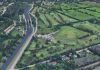

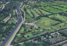













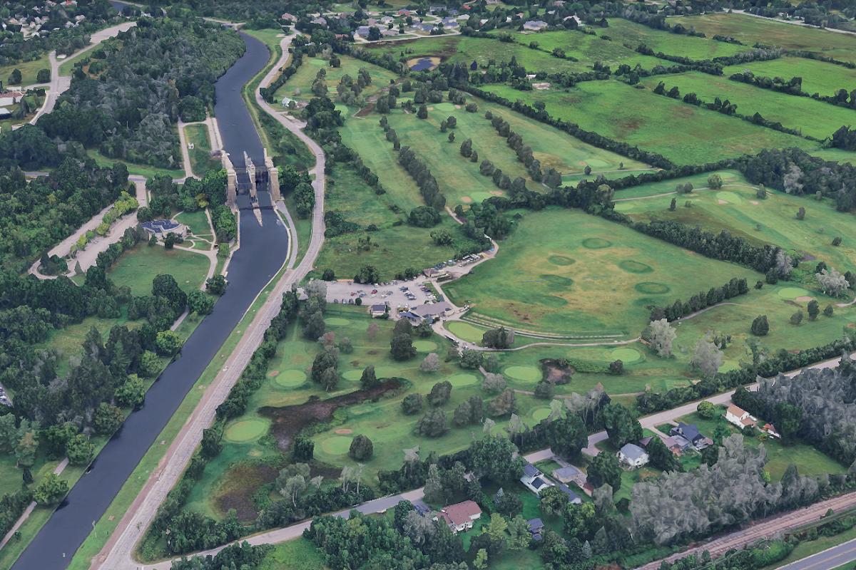
Peterborough residents have just over a week left to comment on the environmental study that lays out how the city proposes to realign Ashburnham Drive and replace the McFarlane Street Bridge north of the Peterborough Lift Lock.
The preferred design would move Ashburnham Drive east from its present alignment between Maniece Avenue and McFarlane Street, build a new two-lane McFarlane bridge immediately north of the existing one, add sidewalks and cycling lanes, and change several intersections and local road connections. The preliminary cost is $27.8 million in 2025 dollars, excluding property acquisition and some utility and servicing costs.
The public comment period on the Environmental Study Report closes Monday, November 16. Once the environmental assessment process is complete, the project would proceed to the next stages, which include detailed design, permitting, and property acquisition. As the city currently considers it a medium-term infrastructure project, construction would be within 10 to 20 years and subject to future funding priorities.
What the preferred design would change
Much of Ashburnham Drive north of the Lift Lock runs along the canal embankment, where limited space and poor sightlines make it difficult to add sidewalks, cycling infrastructure, and other improvements.
Under the preferred design, the road would shift eastward between Maniece Avenue and McFarlane Street and become a two-lane urban road with sidewalks and cycle tracks on both sides.
Intersections at Maniece Avenue, Hunter Street, and Old Norwood Road would be modified, while portions of the existing Ashburnham Drive corridor beside the Trent-Severn Waterway could eventually be repurposed for recreational or active transportation uses.
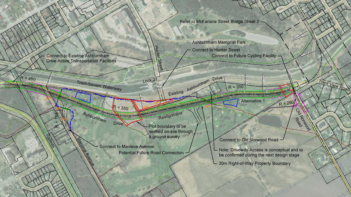
A new curved McFarlane Street Bridge would be built immediately north of the existing bridge. Unlike the current single-lane crossing, it would have two vehicle lanes and include cycling lanes and sidewalks on both sides.
The existing bridge could potentially remain as a pedestrian and cycling crossing and heritage feature, although that would require further study and discussions with Parks Canada, which owns the structure.
The design would also replace the existing connections from Watts Avenue and Trentview Road with cul-de-sacs.
A project years in the planning
The proposed realignment grew out of the city’s Eastside Transportation Study, which examined infrastructure needed to accommodate development and population growth east of the Trent-Severn Waterway. Completed in 2023, the study identified the Ashburnham Drive realignment and bridge replacement as priority projects.
City council initially considered the preferred design in May, but deferred a final decision after hearing concerns from an affected Trent View Road property owner, directing staff to address those concerns before returning to council.
Staff and consultants subsequently reviewed alternatives and refined the preferred design, including reducing the footprint of the proposed Trentview Road cul-de-sac.
Council unanimously approved the environmental assessment recommendations on September 14, allowing the Environmental Study Report to proceed to the current public review period.
Property and environmental impacts remain significant
The project would require the city to acquire three private properties, including one residential property and two vacant parcels.
In total, approximately 3.58 hectares of private property would be needed, with most of that involving the existing Liftlock Golf Course lands that are being planned for redevelopment.
The preliminary $27.8-million estimate includes about $17.3 million for the Ashburnham Drive realignment and $10.5 million for the new bridge, but does not include property acquisition or some utility and servicing costs.
The project would also affect vegetation, golf course ponds, and portions of Golf Course Creek and Whitlaw Creek.
More detailed environmental work would be completed during the design stage, including assessments of wetlands, fish and wildlife habitat, species at risk, trees, and archaeological resources. The city would also need approvals from agencies including Parks Canada and Otonabee Conservation.
What happens after the November 16 deadline
Residents can review the Environmental Study Report through the city’s Connect Peterborough website at www.connectptbo.ca/ashburnhamea or in printed form at Peterborough City Hall and the Peterborough Public Library.
Comments and questions can be submitted to the city at ashburnhamEA@peterborough.ca until November 16.
After the environmental assessment is completed and subject to provincial approval, the project would move into detailed design, including the road and bridge layout, intersections, drainage, cycling and pedestrian connections, construction staging, environmental mitigation, and utility relocations. It would also include further discussions with affected property owners and the formal property acquisition process.
The city would also have to decide what to do with the existing McFarlane Street Bridge. If retained for pedestrians and cyclists, the city could have to assume ownership from Parks Canada as well as future maintenance responsibility.
The preferred design would allow much of the new bridge to be built while the existing crossing remains in use, reducing the need for a lengthy full closure during construction.
Local residents who are already concerned about the amount of development happening in East City over the next couple of years — including the replacement of the Maria Street Swing Bridge on Ashbunrham Drive to the south and the construction of a 17-storey high-rise on Hunter Street East at Mark Street — need not worry about this project, as construction is not imminent.
The Environmental Study Report identifies the project as a medium-term transportation improvement, with construction currently recommended within a 10 to 20 years. The project is not yet identified in the city’s capital plan, which normally includes projects within a 10-year timeframe.
As such, the future of the project — including detailed design, property acquisition, permitting, and eventual construction — will depend on future council budget decisions, funding availability, regulatory approvals, and the timing of growth-related transportation needs.