





















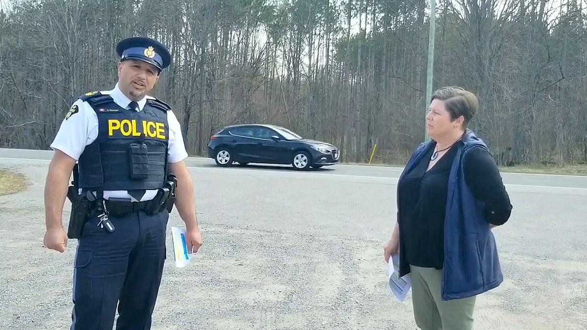
North Kawartha mayor Carolyn Amyotte is expressing concern after a review by the Ministry of Transportation of Ontario (MTO) found there is no reason for significant infrastructure changes to Highway 28.
MTO completed an operational performance review (OPR) of the provincial highway to identify existing or emerging safety and operational concerns and to provide recommendations for potential countermeasures along three segments of the provincial highway between Lakefield and Bancroft.
“Overall, the review found that Highway 28 is operating acceptably from both a traffic flow and intersection performance standpoint,” a summary report from MTO states. “Although the corridor experiences moderate volumes, seasonal surges, and a high proportion of wildlife-related collisions, the study concludes that no major capital improvements are warranted at this time.”
Highway 28 mayors pushed province for safety review
The OPR comes two years after Amyotte put a call out to other mayors of communities along Highway 28 to form a coalition to advocate for greater safety following several serious motor vehicle collisions on the highway.
Ensuring safety on the roadway has been her focus since 2019, when a friend and neighbour was killed in an accident on the highway. By 2022, North Kawartha had installed two designated “community safety zones.”
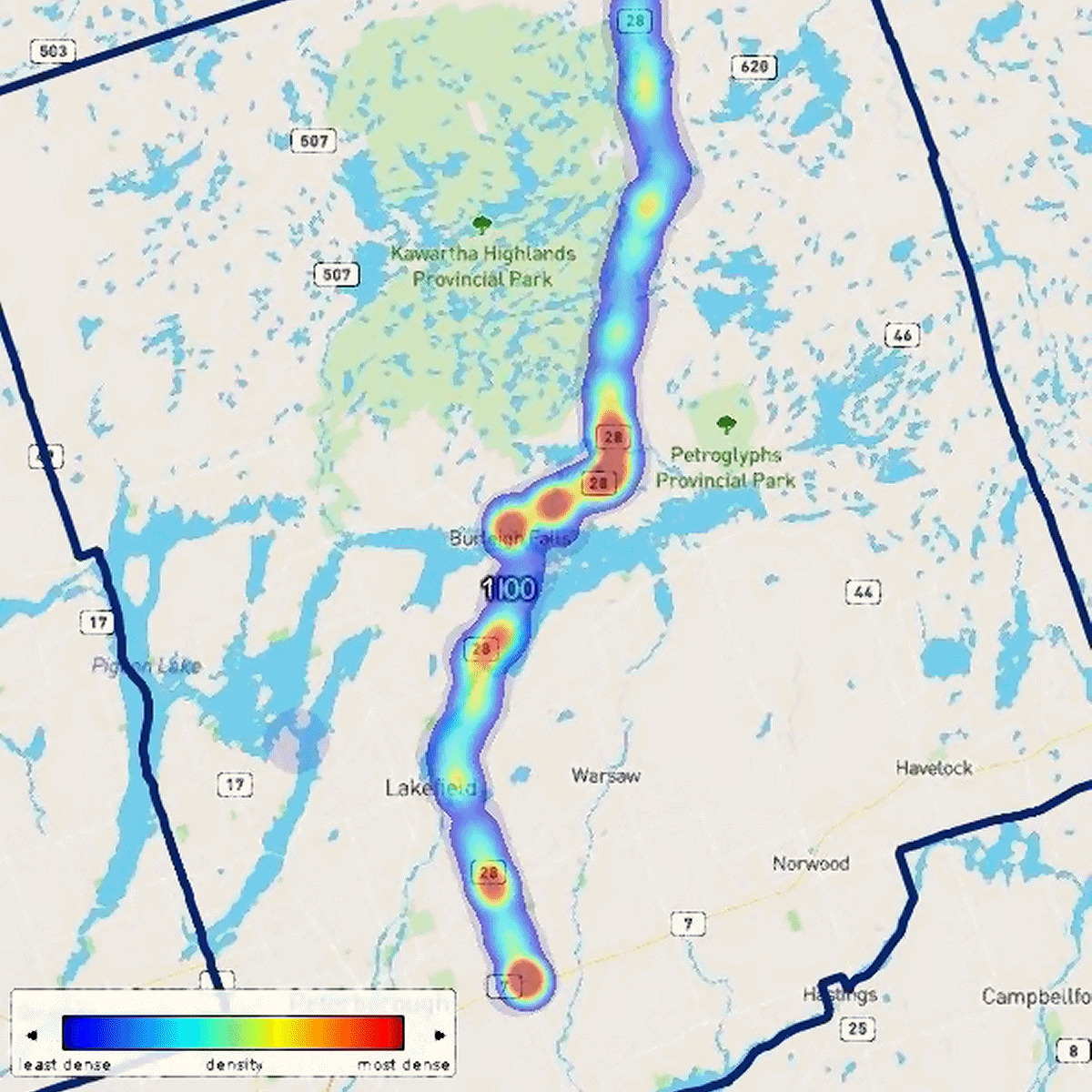
“All communities along Highway 28 share the same concerns and have the same vetted interests in making this highway as safe as possible,” Amyotte says. “There’s a disconnect between the good design of the road and its meeting all the standards and technical aspects-but at the end of the day, there are accidents and there are issues that are happening and they’re happening in the same spots over and over again. There’s a pattern here and we need to address it.”
The mayors in the coalition endorsed a letter sent to the minister requesting a delegation with MTO at the Rural Ontario Municipal Association (ROMA) conference in January 2025 urging for a safety review, improved communication between the MTO and Highway 28 municipalities, and collaboration to target public awareness.
The delegation was well-received, and MTO agreed the comprehensive safety review would be done last summer. The review was completed in September and, since then, the mayors’ coalition has been waiting for the results. On June 25, the coalition had a virtual meeting with MTO staff who presented the review’s findings and, at Amyotte’s request, providing a written summary of the review a few weeks later.
“To say that I and the other mayors were disappointed is an understatement,” Amyotte told kawarthaNOW in a recent email.
Review examined three sections of Highway 28
Almost 163 kilometres long, Highway 28 runs from Highway 7 east of Peterborough north through Bancroft to Highway 41 in Denbigh, passing through four counties and 11 municipalities. North of Monck Road, just south of Bancroft, the highway is not provincailly owned.
The OPR evaluated three segments of the highway between Lakefield and Bancroft: just north of Thelgar Road in Douro-Dummer Township to 800 metres north of Clear Lake Road in Selwyn Township; 400 metres south of Haultain Road to the Eels Creek crossing in North Kawartha Township; and 200 metres east of Lower Faraday Road to 200 metres west of Valleyview Drive south of Bancroft in Hastings County.
The review examined existing traffic operations, safety performance, roadway geometry, roadside elements, and illumination warrants, and was supported by turning-movement counts, speed studies, collision records, field observations, and stakeholder feedback.
It found that, while vehicle speeds are often near or above the posted limits and speed “occasionally” contributes to crashes, nearly half of all recorded collisions were wildlife related.
“A LOSS (Level-of-Service-Safety) review found several segments (of Highway 28) performing worse than expected for similar highway facilities,” the summary report states. “However, none met the threshold for severe underperformance, and these findings primarily reinforce the need for localized monitoring rather than major redesigns.”
North Kawartha mayor says review falls short
Amyotte says MTO’s review is not what the mayors’ coalition was expecting.
“The OPR reads primarily as a current conditions assessment and it concludes that Highway 28 is operating acceptably, but it doesn’t give us a broader safety analysis — that’s what we requested,” Amyotte says.
“It lacks corridor-wide trend line analysis for the traffic volumes, peak weekend volumes, the collision frequency and severity, altering movements of the location-specific safety performance — those kinds of things.”
In a response sent back to MTO, Amyotte points out the review does not include the thresholds that would lead the Ontario government to consider improvements like left-turn lanes, acceleration lanes, right-turn tapers, enhanced signage, or other safety countermeasures. She adds the report “doesn’t fully address” the collision hot spots that multiple communities and emergency services have identified.
“I’m also not sure if they’re taking into consideration the operational impacts on rural municipalities and things like our volunteer emergency services, the extended road closures, limited detour options — all of that needs to be addressed,” Amyotte tells kawarthaNOW.
Amyotte adds that Highway 28 operates differently than when it was first constructed, due to infrastructure advancements like the 407 now connecting to the 115, while communities like North Kawartha, Bancroft, and Faraday have all increased their populations over the past several years.
“Just looking at our own data, we’re seeing the patterns in terms of responding to the same locations, over and over again, year after year,” she says, referring to collisions.
“Fatal or not, every single accident is a life-changing event, not just for the victims. It’s for the responders that are there, the OPP, the paramedics, the firefighters, time and again. It is huge and it has an impact on the psyche of all the people that are travelling on that road.”
Amyotte seeking stronger provincial action
Despite the overall assessment, the OPR outlined some recommended actions that focus on cost-effective maintenance, continued monitoring, targeted data collection, and other maintenance and minor improvements to be addressed in 2026.
These include reviewing wildlife warning signs, adding additional signage, refreshing pavement symbols, implementing rumble strips on shoulders, and more.
“The analysis revealed specific localized issues related to wildlife collisions, driveway activity (particularly near Kawartha Dairy), geometric constraints at select intersections, minor visibility and signage deficiencies, and isolated issues with guiderails and pavement markings,” the summary report states.
Amyotte says the suggested improvements are “not enough” and, in her response to MTO, is requesting a written addendum or supplemental response that outlines several concerns.
Those include a location-specific assessment of identified hot zones, the specific warrant thresholds that would prompt infrastructure change, a clear monitoring plan, a commitment to regular communication with Highway 28 municipalities, a collaborative education and enforcement strategy, and more.
She is calling on member municipalities to review the OPR summary report and endorse North Kawartha’s response letter, or follow it up with specific monitoring information that can be provided to MTO.
“When I hear from members of the public, as well as the other mayors in the other communities, we’re all on the same page,” Amyotte says.
“We all know how important it is. It’s just a matter of how do we get there? How can we build that relationship and share that knowledge and information and just work to make it safe for everybody as much as we can? We want to be proactive rather than reactive.”