Environment Canada is continuing the rainfall warning for the Kawarthas region on Friday (May 5).
As of 2 p.m. on Friday afternoon, Environment Canada has reported the following rainfull totals:
- 51.8mm in Trent
- 48.3mm in Cobourg
- 33.8 mm in Peterborough
- 25.3 mm in Bancroft
Rain is forecast to persist through Saturday, as the weather system responsible for the precipition stalls over the region. The rain will be heaviest on Friday evening, with another 10 to 15 mm forecast, after which it should become lighter.
The total amount of rain may reach 70mm before the system moves out of the area.
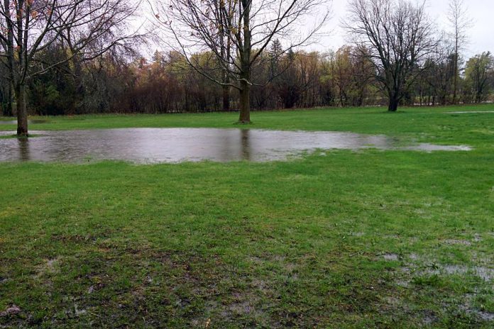
With the ground already saturated, there is the potential for local flooding, particularly in low-lying areas. Keep children and pets away from creeks and river banks. Consider moving valuable items in your basement to higher levels.
Otonabee Conservation has also updated its Flood Warning for the area. Current watershed conditions, combined with the latest weather forecast, suggest that water levels on the Kawartha Lakes (Buckhorn, Chemong, Pigeon, Lower Buckhorn, Lovesick, Stony, Clear and Katchewanooka Lakes) could experience unprecedented heights in the coming days.
Residents on these lakes are advised to prepare now by taking appropriate steps to protect themselves, their family members, their pets and their personal property. In particular, the following known historical flood-vulnerable areas are advised to take heed of this flood warning (note that this is not an exhaustive list):
| Lake Name | Location Municipality | Location Description |
|---|---|---|
| Pigeon | Selwyn | Kingfisher Drive |
| Pigeon | Selwyn | Fothergill Drive |
| Buckhorn | Selwyn | Rabbit Run Road |
| Buckhorn | Selwyn | Shannon Drive |
| Buckhorn | Selwyn | Duffus Drive |
| Buckhorn | Selwyn | Roger Place |
| Buckhorn | Selwyn | Emerald Isle |
| Buckhorn | Selwyn | Greenwood Island |
| Buckhorn | Selwyn | Fire Route 19 |
| Lower Buckhorn | Selwyn | Fire Route 22 / 23 |
| Lower Buckhorn | Selwyn | Fire Route 25a |
| Lower Buckhorn | Selwyn | Victoria Springs |
| Lower Buckhorn | Selwyn | Deer Bay |
| Chemung | Selwyn | Newforest Drive |
| Chemung | Selwyn | Gifford Causeway |
| Chemung | Selwyn | Gifford Drive |
| Chemung | Selwyn | Pinehurst Ave |
| Chemung | Selwyn | Selwyn Shores Drive |
| Chemung | Selwyn | Upper Chemung Drive |
| Chemung | Selwyn | Fire Route 14b |
| Lovesick | Selwyn | Spring Lane N |
| Clear | Selwyn | Ayotte’s Point Lane |
| Clear | Selwyn | Youngs Point |
| Clear | Douro – Dummer | South Beach Rd |
| Clear | Douro – Dummer | Monroe Island Area |
| Clear | Douro – Dummer | Salmon Bay Rd |
| Katchewanooka | Selwyn | Fire Route 55 |
| Katchewanooka | Douro – Dummer | Englewood Lane |
| Stony | Selwyn | Rock Crossway Lane |
| Stony | Douro – Dummer | Juniper Island |
| Stony | Douro – Dummer | McCracken’s Landing |
| Stony | Douro – Dummer | Hawkins Line |
| Stony | Douro – Dummer | Moore Island |
| Stony | Douro – Dummer | Gilchrist Bay |
| Stony | Douro – Dummer | Gibson Island |
| Stony | Douro – Dummer | Puffers Shore Road |
| Stony | Douro – Dummer | South Bay Shore Rd |
| Stony | Douro – Dummer | Fire Route 31 |
The Otonabee River may also experience unprecedented water levels and flows as a result of current watershed conditions when combined with the updated weather forecast. Residents located in historically flood-prone areas should take appropriate steps to protect themselves, their family members, their pets and their personal property ahead of the rising waters. In particular, the following known flood-vulnerable areas are advised to take heed of this flood warning: Cambelltown; Rosa Landing Road; Bensfort Bridge area; Jones Road; Deyell Road; Seven Oaks Drive; Wallace Point area; Cedar Bank Road; Green Acres Road; and, Willow Road / Matchett Line area (note that this is not an exhaustive list).
As the Kawartha Lakes and Otonabee River rise, there may also be backwater and tailwater conditions that cause flooding on the tributaries to these waterbodies and watercourses including, but are not limited to, Ray’s, Sawer, Jackson, Meade, Byersville, Riverview, Tompson, Bears, Cavan, Baxter and Squirrel Creeks.
Throughout the remainder of the Otonabee Region watershed, significant pooling and ponding can be expected in low-lying areas where there is poor drainage. As well, local rivers (Indian and Ouse Rivers) and creeks, which are already flowing at rates well above normal, will continue to experience very high flows and may even exceed their normal confines in those areas of low sidewalls and banks. Area residents located in historical flood-vulnerable areas are advised to prepare.
Area residents as well as visitors to the are, are advised to observe caution around all waterbodies and watercourses because area lakes, rivers, streams and creeks pose a serious danger due to high levels, very fast flows and extremely cold water temperatures. Dams, culverts and other water control and water conveyance structures should be avoided at all times.


